TRAVELING AND MAJOR CITIES
Traveling into the country would most likely be plane rides, but you could also drive, take a boat, or travel by train.
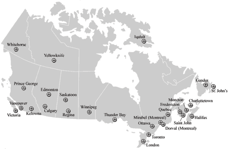
A map of major national air ports
To check plane fairs or car rentals go to http://www.skyscanner.com/flights-to/ca/cheap-flights-to-canada.html. There are many airports, a lot of them but for major cities there is the List of CanadianAéroports de Montréal, Aéroport de Québec Inc., Charlottetown Airport Authority Inc., Edmonton Regional Airports Authority, Gander International Airport Authority Inc., Fredericton International Airport Authority, Greater London International Airport Authority, Greater Moncton International Airport Authority Inc., Greater Toronto Airports Authority, Halifax International Airport Authority, Ottawa Macdonald-Cartier International Airport Authority, Prince George Airport Authority Inc., Regina Airport Authority, Saint John Airport Inc., Saskatoon Airport Authority, St. John’s International Airport Authority, The Calgary Airport Authority, Thunder Bay International Airports Authority Inc., Vancouver International Airport Authority, Victoria Airport Authority, Winnipeg Airports Authority Inc. list and links to airports from http://www.tc.gc.ca/eng/programs/airports-mapcaa-64.htm
The map above shows the major cities, which include Vancouver, Quebec, Ottawa, Montreal, and etc.
In these cities transpiration, if not by rental car, would consist of bus, and perhaps a train of some sort. There are a lot of rivers, the great lakes and the oceans and seas nearby so it is not uncommon for boat transportation. The major cities most likely have something that is a public transport, in Vancouver there is this system of rails called Sky-train.
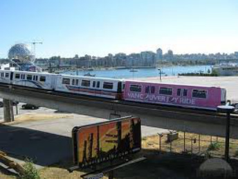
skytrain
Transportation systems like this effect the economy, if you have a fast network of transportation, you can get things to places faster, so when towns have a big route for transportation around them they progress and become more advanced making the economy better. A bus may cost about 5$ for a short distance probably less in some cases. Travel between cities can be by plane, bus and driving. Literary if you need information like traveling between cities and prices use this
https://www.tc.gc.ca/media/documents/policy/report-final.pdf go to page 34 it has charts of the transportation between major cities, and prices of those.
|
Sky-train connects a lot of major centers around Vancouver. There are three lines and a fourth line is scheduled to be finished by 2016. It is a major transportation system because it is used everyday by many people and connects. To travel just about anywhere it doesn't succeed 10$ for single fair, it is pretty cheap. For adults in zone one it is $2.75, zone two is $4, and zone three is $5.50, and going to the airport cost varies. The canada line is free if you travel in the three sea island stations which can include the airport. This was chosen as a main transport system because it is very long and vast, it is also very useful to the citizens of Canada.
|
|
|
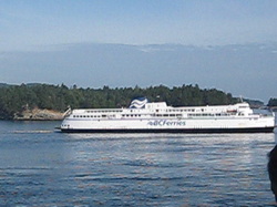
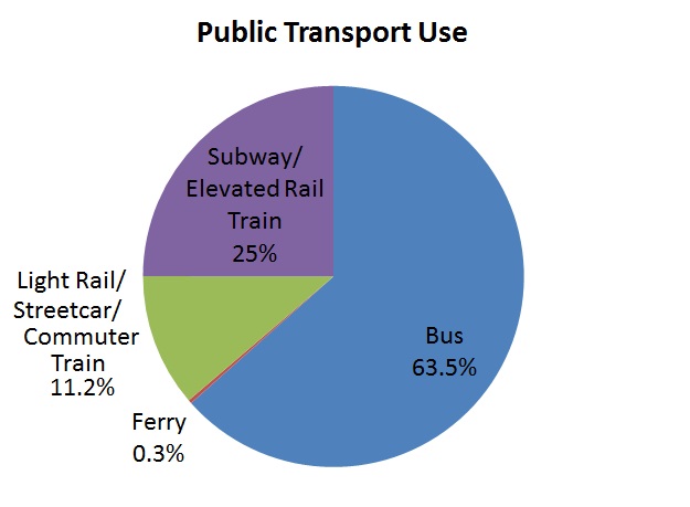
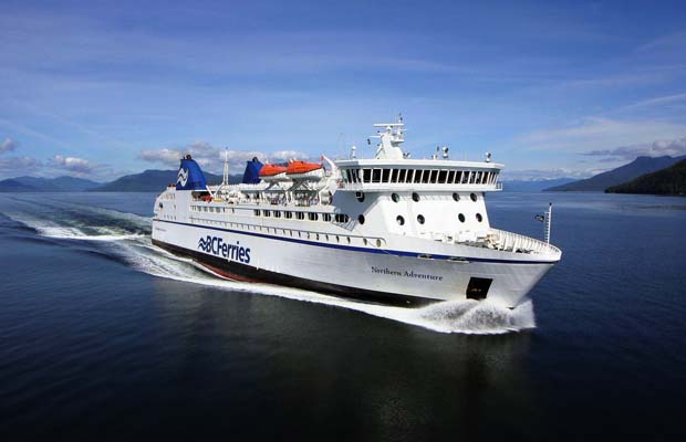
For ferry rides you will spend at least 6 dollars and at most 15 dollars on BCFerries. Despite all of the waterways it isn't used to much, as shown in the survey below. It is mostly for long distances so unless you are just visiting it wouldn't be very useful to people who live there, but for tourists it would help. For specific fairs on BCFerries go to http://www.bcferries.com/files/fares/pdf_format/BCF_Fares.pdf